2021 - The Laugavegur trail is a 55 km multi-day trek with non-stop breathtaking views. It flows through the Icelandic wilderness with scenery constantly shifting between rainbow striped mountains, highland snowfields, black sand deserts and green moss covered mountains. Among National Geographic world’s top 20 ranked hikes.
WORTH TO REMEMBER
-
For reaching the beginning, it takes 10 mn of walk. The route is composed of 4 sections very distinct.
-
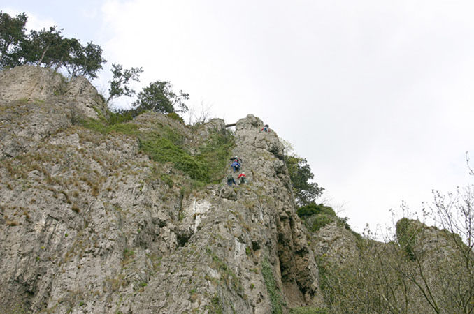
The candle begins to the right of the climbing school of the Chironne. After going up to the large slab, a corner carries out you to the breach of the candle. An easier alternative with an escape is possible by going up the wall on left side.
-
The crossing of the roofs is the most impressive section of the course. This part presents of many athletic and vertiginous over- hangs and leads to the large ledge.
-
The large ledge is also accessible by the Candle. A cabled way makes it possible to join the exit of the crossing of the roofs. This place is a splendid view-point on the country of Diois. This narrow and vertiginous passage carries out you to the last part.
-
The exit of the slabs makes it possible to reach the summit of the cliff. A marked path brings you back into 20 mn to the starting point.

BEST TIME
The weather can be quite unpredictable, no matter the season. You must be prepared for low temperatures, heavy rain and wind, and sometimes snow (yes, even in the summer months). The area is prone to quick and sudden changes in weather causing rapid fluctuations in temperature
CONDITIONS
Featuring multicolored rhyolite mountains, volcanic deserts and icecold waters to wade through, prepare yourself for a good hike in fog, rain, sun or hail. No climbing experience needed. Take a good tent and sleeping bag with you.
FOOD & TRAVELLING
This moderate trail requires endurance. The highest point is 1059 m, with elevation changes of anywhere up to 490 m each day. Huts and camp sites can be found along near Hrafntinnusker, Álftavatn, Hvanngil and Emstrur.


